

Map of Chad
All our destinations, heritage sites and journey routes on one interactive map.
- The Ennedi Massif
- The Lakes of Ounianga
- The Tibesti Mountains
- Rock art of the Chadian Sahara
- Zakouma National Park
- Ouadi Rimé-Ouadi Achim Reserve
- Lake Chad
- The Gerewol of the Wodaabe
- Guelta of Archei
- The Aloba Arch
- Guelta of Bachikélé
- Terkei
- The Oyo Labyrinths
- The Lyre Arch (Djolio)
- The Elephant Rock
- Fada
- Ounianga Kébir
- Ounianga Sérir
- Emi Koussi
- The Trou au Natron
- The Soborom Hot Springs
- The heart of Zakouma
- The Rigueik Pans
- Addax, oryx and gazelle reserve
- The Bol Archipelago
- National Museum — Toumaï
- Bubaline period
- Bovidian period
- Caballine period
- Cameline period
- The Gerewol
Archives NBC Discovery
Les itinéraires tels que nous les traçons
Les cartes de travail de l'agence, relevées sur le fond officiel du ministère des Affaires étrangères.
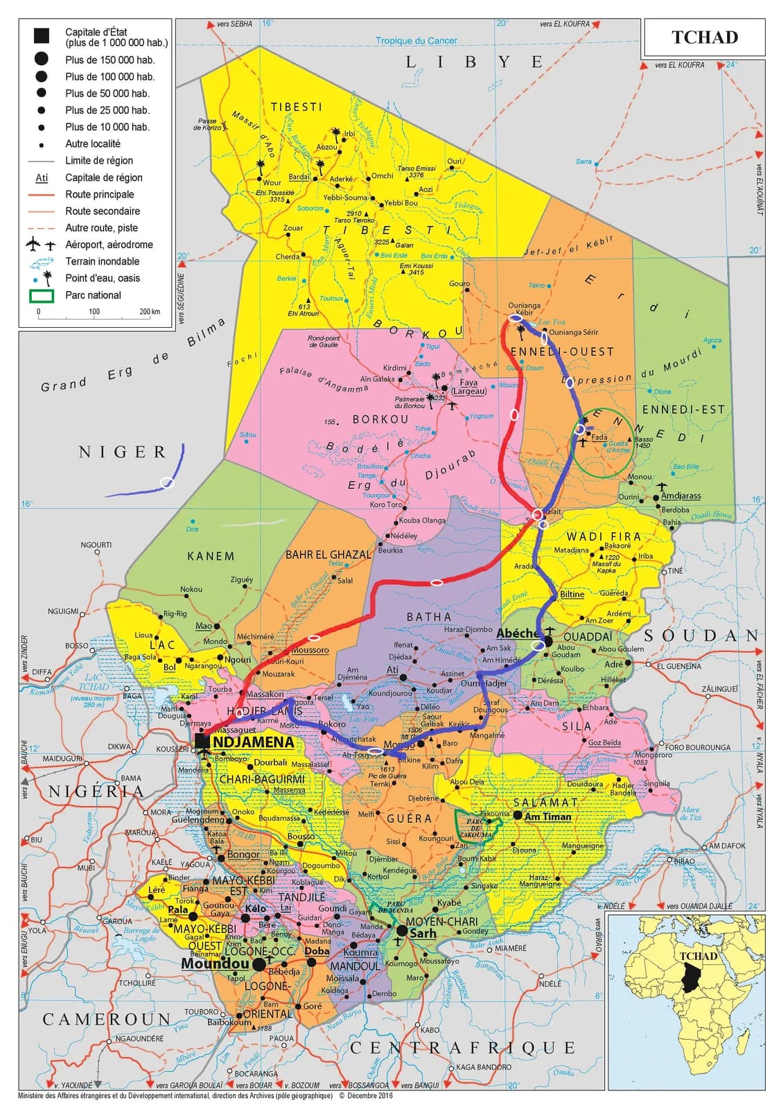
N'Djamena – Kalait – Ounianga – Fada – Abéché
La grande boucle du nord, aller par le Djourab, retour par le Ouaddaï.
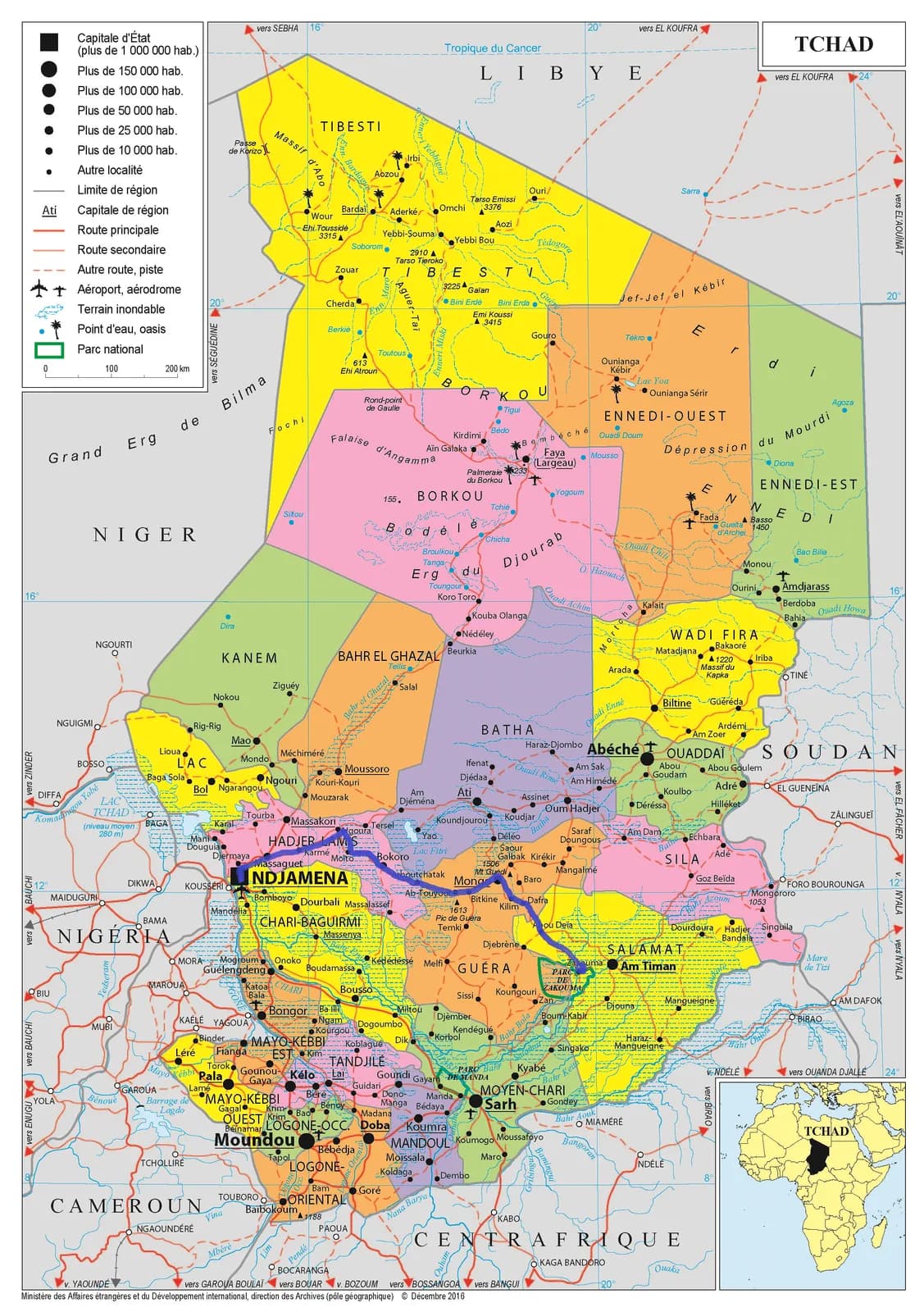
N'Djamena – Mongo – Zakouma – Am Timan
La descente vers la savane soudanienne et le parc national.